No forums found...
Site Related
Iowa State
College Sports
General - Non ISU
CF Archive
Install the app
***Official 2025 Weather Thread***
- Thread starter wxman1
- Start date
No forums found...
Site Related
Iowa State
College Sports
General - Non ISU
CF Archive
You are using an out of date browser. It may not display this or other websites correctly.
You should upgrade or use an alternative browser.
You should upgrade or use an alternative browser.
Stupid expensive for parking a car, but gotta think about springing for a garage spot.Crap, we leave for vacation tomorrow not coming back until Wednesday. Hate leaving a car at the airport knowing that
Hoping the rain stays north this afternoon as I'd like to get out golfing
They had a slight risk for the state for a couple days and now bumped it up. KWWL brought it up on Tuesday. I don't remember seeing a SPC chance that far out before.That looks like a bullseye over the state of Iowa. It is an early projection, but these early projections have been pretty accurate lately.
There is a new indoor parking place that as part of it will drop you off and pick you up.Crap, we leave for vacation tomorrow not coming back until Wednesday. Hate leaving a car at the airport knowing that
Lots of energy available next Monday afternoon...
View attachment 148384
I generally do not like to see bright red and pink blobs over my house when looking at weather maps. I assume this energy map should provide the same level of concern?
If we can't get a ride we might do thatThere is a new indoor parking place that as part of it will drop you off and pick you up.
45% risk already for Monday?
Don't recall seeing a forecast map where the worst of the weather is so perfectly centered on the state of Iowa
Be safe on Monday everyone. It looks like a day where every warning should be taken very seriously
So what is the timing of this? Monday day, evening, or night? I have a flight out of DSM Tuesday at 5am. Any chance it stretches into that timeframe?
Yeah, thinking probably around 5 pm when in Des Moines tbh. Could change of course.So what is the timing of this? Monday day, evening, or night? I have a flight out of DSM Tuesday at 5am. Any chance it stretches into that timeframe?
Good; just hoping it stays after school time at least.Yeah, thinking probably around 5 pm when in Des Moines tbh. Could change of course.
Monday afternoon commute will be interesting.Yeah, thinking probably around 5 pm when in Des Moines tbh. Could change of course.
That looks like a bullseye over the state of Iowa. It is an early projection, but these early projections have been pretty accurate lately.
Monday will be just a few days past the 1 year anniversary of Greenfield. Iowa can cook in April.
45% risk already for Monday?
eek. Buh-bye Ottumwa.
Greenfield was May 21st.Monday will be just a few days past the 1 year anniversary of Greenfield. Iowa can cook in April.
Stupid expensive for parking a car, but gotta think about springing for a garage spot.
The garage has been full the last several times I’ve tried to park there.
Greenfield was May 21st.
My bad. Would be just past the anniversary of the Minden tornado.
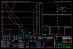
 Sounding over Ames on 4pm on Monday. Textbook tornado threat across the board with enormous storm energy (CAPE), curved hodographs, 67F dews, and storm helicity of 192. The (very slight) saving grace here is that wind shear, significant tornado parameter, and helicity is a little bit on the lower side for a really high end violent tornado threat.
The other thing to note is that a lot of models might not convect any big storms in Iowa- so I think this could be a little more conditional threat or it could be discrete supercells - NWS Des Moines has noted this in their (admittedly slightly out of date) forecast discussion this morning: https://forecast.weather.gov/produc...MX&product=AFD&format=CI&version=1&glossary=1.
"However, model guidance over the last few runs has struggled to
produce much convection associated with this system as it moves
through Iowa, potentially due to a lack of convergence as it
moves through. That said, it may also be due to the expectation
of discrete convection, which may not be getting captured well
by the coarser global models. Therefore, the potential for
severe weather on Monday is certainly there, but we will want to
continue to keep an eye on guidance in the coming days,
especially once we get nearer to the high resolution window."
Below is GFS at 4pm on Monday.

With any luck we survive Monday- last year's tornadoes in Minden and Greenfield legitimately gave me PTSD and I've been stressing all year and all winter for another event like this in the spring.


