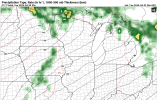
That is around what we had also..3” of rain in North Ames this morning.
No forums found...
Site Related
Iowa State
College Sports
General - Non ISU
CF Archive
Install the app
***Official 2025 Weather Thread***
- Thread starter wxman1
- Start date
No forums found...
Site Related
Iowa State
College Sports
General - Non ISU
CF Archive
You are using an out of date browser. It may not display this or other websites correctly.
You should upgrade or use an alternative browser.
You should upgrade or use an alternative browser.
Another .4" in Marion. Brings us to just shy of 3" in the last 48 hours.
They're not that rare these days due to machine learning models like CSU-MLP, but I'm actually quite concerned about this one as the SPC mentioned "all-hazards" on Day 7 already which means tornadoes. https://www.spc.noaa.gov/products/exper/day4-8/Rare Day 7 Slight Risk out for the Plains/Midwest, including Iowa. That would be Monday.
I think there could be capping issues though, the ECWMF showed a line of storms coming from Nebraska into Iowa yesterday, while the GFS showed supercells in Iowa, but now both models are showing barely any storms during that timeframe (4-10 pm next Monday) despite the environment being otherwise favorable.
I think the culprit could be the elevated mixed layer here (the green dew point line in the hodograph being relatively low a few kilometers at the surface compared to higher and lower up, this is a layer of dry air that oftentimes prevents surface based storms- the storms that produce those green skies that come before really bad weather).


Setting up for the Omaha hot spot.Rare Day 7 Slight Risk out for the Plains/Midwest, including Iowa. That would be Monday.
So many jokes, so little time.South side pounded
Another.3” of rain, still waiting to finish corn planting. 1 f###ing day left.
I feel like Waukee has a forcefield around it.
Storms keep going around or breaking up before they hit.
Storms keep going around or breaking up before they hit.
I thought the heavy rain chance was tonight
Wasn’t expecting a soaker on the way into work this morning
Wasn’t expecting a soaker on the way into work this morning
That looks like a bullseye over the state of Iowa. It is an early projection, but these early projections have been pretty accurate lately.
Crap, we leave for vacation tomorrow not coming back until Wednesday. Hate leaving a car at the airport knowing thatThat looks like a bullseye over the state of Iowa. It is an early projection, but these early projections have been pretty accurate lately.

