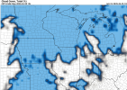
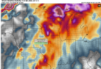
Crazy how identical that looks. Current one is a bit further west. Lost our house last year, can’t help but get anxious to get through Monday at this point.
No forums found...
Site Related
Iowa State
College Sports
General - Non ISU
CF Archive
Install the app
***Official 2025 Weather Thread***
- Thread starter wxman1
- Start date
No forums found...
Site Related
Iowa State
College Sports
General - Non ISU
CF Archive
You are using an out of date browser. It may not display this or other websites correctly.
You should upgrade or use an alternative browser.
You should upgrade or use an alternative browser.
Forecasting keeps getting better and better. I always cringe when people say the weather man is always wrong. I think that couldn’t be further from the truth and I’ve noticed even in the last decade forecasting seems more accurate. Sometimes certain events get overhyped, but they usually nail the location and timing.So I've seen a lot of "We don't usually see warnings this far out" comments lately. Has something changed in forecasting, like AI, or are we seeing changing weather patterns?
1.1 for meYet another morning with .9" of rain in the gauge in North Ames.
I got hit by the White Oak/Nevada tornado last year... 2 weeks of tree removal and cleanup. What are the odds of a tornado hitting the exact same location 2 years in a row. Pretty low right? Someone talk me off the ledge.
Astronomically low.
The odds of you getting hit are the same regardless of whether you have been hit before.I got hit by the White Oak/Nevada tornado last year... 2 weeks of tree removal and cleanup. What are the odds of a tornado hitting the exact same location 2 years in a row. Pretty low right? Someone talk me off the ledge.
Don’t want to freak you out, but I saw it happened in Arkansas. Same neighborhood just different damage to same houses. They were hit in may of last year and March this year. That is just insane.I got hit by the White Oak/Nevada tornado last year... 2 weeks of tree removal and cleanup. What are the odds of a tornado hitting the exact same location 2 years in a row. Pretty low right? Someone talk me off the ledge.
:max_bytes(150000):strip_icc():focal(694x635:696x637)/tornado-damage-1-031825-d96717fe4a6242309159bffef1319223.jpg)
Family Survives 2nd Tornado in a Year as Mom Says 'God Just Had His Hand' Over Them
Multiple homes in Arkansas that were hit by a tornado during the 2025 St. Patrick’s Day weekend outbreak were hit by a separate tornado nearly a year prior.
I realize it's odds, just like winning at the casino slot machines, I just wanted someone to lie to me. Thanks for nothing.The odds of you getting hit are the same regardless of whether you have been hit before.
The odds are still extremely low.I realize it's odds, just like winning at the casino slot machines, I just wanted someone to lie to me. Thanks for nothing.
The odds are still extremely low.

50/50The odds are still extremely low.

It's still a little early for the higher resolution models (HRRR, NAM) for Monday but the latest GFS is showing actual convection and potentially discrete/embedded supercells in Iowa from 4-10pm on Monday.

Here is a sounding for Ames, IA on 4pm on Monday- decent low level curvature that gets better as the night wears on, upper 60s dew points, over 3,000 Surface-Based CAPE, and 54 knots of wind shear is a very potent setup for all modes of severe weather if a supercell moves over, even strong tornadoes. Again the main thing that is stopping this from being an upper upper echelon event is the helicity- around 200 helicity is good for tornadoes but a little low for the really violent ones like the ones that hit Greenfield last year. Of course an unlucky boundary interaction and that could be overcome.
 Another potential limiting factor for a tornado outbreak is Iowa will likely have near total cloud cover for most of Monday (this is Monday morning at 10am) and that could dampen the instability somewhat, though not nearly enough to prevent severe weather outright especially given there is the occasional break in the clouds.
 Map of helicity at 7pm on Monday (still a tad early for helicity tracks)- blue is 100 m2/s2, orange is 200 m2/s2, red is 300 m2/s2, purple is 400 m2/s2. The SPC defines the ideal environment for strong tornadoes to be around 247-402 m2/s2 helicity: https://www.spc.noaa.gov/exper/envbrowser/, and the higher helicity values are generally gonna be east of I35, so I think that's looking to be where the largest potential for tornadic action will likely be from this model- of course that can change as high resolution models come into play (and GFS is historically very bullish and somewhat chaotic on tornadic setups).
It looks like the CSU-MLP model (one of the AI models that is a big reason why forecasting has become so accurate this year) is currently placing the biggest risk over eastern Iowa, western Wisconsin, southeast Minnesota which lines up with what I said above with helicity, though again that can change in 4 days (yesterday it was right over central Iowa)
So are we talking about spotty tornadoes, or is there a possibility of a widespread wind event like a derecho happening?
“All hazards possible”
I got hit by the White Oak/Nevada tornado last year... 2 weeks of tree removal and cleanup. What are the odds of a tornado hitting the exact same location 2 years in a row. Pretty low right? Someone talk me off the ledge.
I know someone whose house was destroyed in a tornado in 2000. They rebuilt the exact same house and it was destroyed in 2008 in another tornado.

