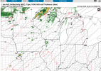
@ribsnwhiskey why is this dumb? It looks like they were pretty correct with this predictionFor reference, Day 3 Greenfield last year:
Storm Prediction Center May 19, 2024 0730 UTC Day 3 Severe Thunderstorm Outlook
Severe weather, tornado, thunderstorm, fire weather, storm report, tornado watch, severe thunderstorm watch, mesoscale discussion, convective outlook products from the Storm Prediction Center.www.spc.noaa.gov
No forums found...
Site Related
Iowa State
College Sports
General - Non ISU
CF Archive
Install the app
***Official 2025 Weather Thread***
- Thread starter wxman1
- Start date
No forums found...
Site Related
Iowa State
College Sports
General - Non ISU
CF Archive
You are using an out of date browser. It may not display this or other websites correctly.
You should upgrade or use an alternative browser.
You should upgrade or use an alternative browser.
https://www.spc.noaa.gov/products/outlook/day3otlk.html Latest update just dropped. Notably the entire Minneapolis metro is now in the highest hatched risk area.

He and I are having a minor spat and I expect this post to get dumbed, too.@ribsnwhiskey why is this dumb? It looks like they were pretty correct with this prediction
https://www.spc.noaa.gov/products/outlook/day3otlk.html Latest update just dropped. Notably the entire Minneapolis metro is now in the highest hatched risk area.
It also seems to be getting bigger
I received that as well...my community is served by Alliant for both gas and electric!Alliant Energy just sent this email. We have them for gas, city of Ames for electric:
The National Weather Service has forecast severe storms in Iowa and Wisconsin on Monday afternoon and night, April 28. Large hail, damaging winds and tornadoes are possible.
Our crews are prepared to safely respond to any power outages the storm causes. If you see downed lines, please let us know by calling 1-800-ALLIANT (800-255-4268).
I just want to say I’m thankful for all you nerds out there breaking this down for a bunch of slobs
Lol... Same!I just want to say I’m thankful for all you nerds out there breaking this down for a bunch of slobs
TNWSSIt also seems to be getting bigger
Last edited:
What the ladies tell you?It also seems to be getting bigger
He and I are having a minor spat and I expect this post to get dumbed, too.
Oh, you two silly ninnies.
He's really pissy in the Kelsey Jones thread you would have thought it was Ricecakes in the cave.He and I are having a minor spat and I expect this post to get dumbed, too.
More high resolution convection-allowing models are starting to get in range for our severe weather outbreak event on Monday, but they're all actually still quite shy on convecting storms in central Iowa or really anywhere in Iowa (here are some possible radar scenarios at 7-8PM on Monday). Models do struggle at convecting at this range though so we'll have to see if this persists.


The synoptic features of this system are still quite potent, a 50 knot jet ejection (40 knots+ is enough for a significant tornado outbreak) slamming right through Minnesota with a massive warm sector with dews almost at 70 degrees in Iowa (almost tropical levels of humidity) and modest but not insignificant 130-150 m2/s2 helicity.
I do think that the main risk area will be north and east of central Iowa. If we do see a day 1 high risk for violent tornadoes, it will likely be in the triangle between Rochester, MN; Waterloo, IA; and Wisconsin Dells, WI. If the models do hold up like this, the event may be more concerning for Minnesota than Iowa- the storm line that blows up in western Minnesota and heads for the Twin Cities is rotating quite a lot on a number of models so may need to watch that area too.

Yeah that was bizarre.He's really pissy in the Kelsey Jones thread you would have thought it was Ricecakes in the cave.
Can't wait to enjoy that at workalmost tropical levels of humidity
Yeah, but it was pretty slow—-they didn’t get all 5 at once. They are surprised at how high it is. They’ve been here 43 years and are good at predicting what the creek will do and this surprised them. The neighbors are also wondering what’s up.
Hopefully they don’t get one of those 6 inches in a night because they’d probably be
What does it drain into, it’s possible that river is high so it slows downs its tribs that drain into it. 5” in a week is enough to bring most streams up on their own though. That’s an April’s worth of rain in a week.
Now Three4Cy is going on a rampage in the Kelsey Joens thread.He's really pissy in the Kelsey Jones thread you would have thought it was Ricecakes in the cave.


